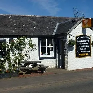
The Farmers Inn Dumfries
Check Availability
Contact Information
🔗 Website
441387870675
🖨️ +441387870675
Address


images


Contacts
Overview
Impressions
Facilities
Rooms
Location
FAQ
The Farmers Inn Review
Featuring Wi-Fi in public areas, The Farmers Inn Dumfries is just an 11-minute walk from Ruthwell Church. A car park is provided on site.
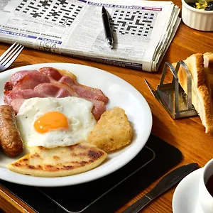
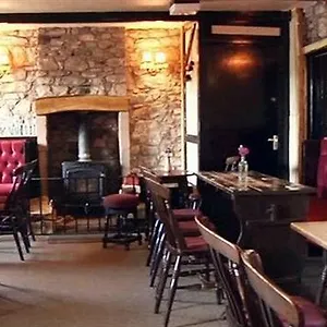
The accommodation serves a gluten-free breakfast. Guests are welcome to the lounge bar to relax with a drink.
You'll need 41-minute drive to Carlisle Lake District airport. Savings Banks Museum is right next to this 2-star inn, while Farmers Inn bus stop is only 300 metres away.
WWT Caerlaverock can also be found around 10 minutes by car from the hotel.
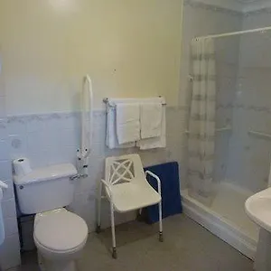
Private bathrooms include nice touches such as a hairdryer and free toiletries.
At this Dumfries hotel a tennis court and an outdoor tennis court are available for an extra charge. If you like an active lifestyle, water sports activities, cycling, and tennis are available on site.


Key Features
- free parking
- free wifi
- family rooms
- non-smoking rooms
- bar
- fabulous breakfast
Impressions
Pros
- Incredibly friendly family-friendly hotel with restaurants and bars.
- Located in a rural area of Dumfries.
- Brand-new and well-equipped units with balcony available with a lovely decor and a tv.
- Some units with nice decor.
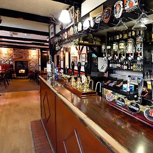
- Pleasant main bar.
- Excellent value compared to other Dumfries properties.
Cons
- Some complaints about the uncomfortable bed.
- A few staff members might seem not very friendly at times.
Facilities
Dining facilities
- Bar/ Lounge area
- Electric kettle
Rooms
- Sitting area
- Terrace
- Garden furniture
- Ironing facilities
- Flat-screen TV
Services
- Welcome drink
Relax
- Water sports
- Cycling
- Tennis court
- Fishing
Activities for Kids
- Children's menu
Rooms

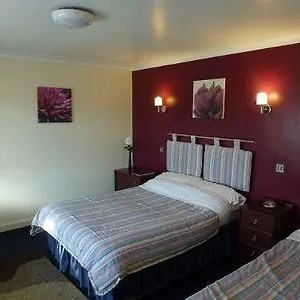
Double Room with Private Bathroom
Location
Landmarks nearby
- Brow Well 1.60 km (0.99 mi.)
- Dino Park 3.72 km (2.31 mi.)
- Ruthwell Cross at the Ruthwell Church 1.45 km (4757 ft)
- Savings Banks Museum 1.54 km (5052 ft)
Transportation
- Farmers Inn 60 m (197 ft)
- Village 560 m (1837 ft)
- Plans 1.13 km (3707 ft)
- Road End 1.13 km (3707 ft)